


Voting District HAMMNT, Jackson County, North Carolina
About
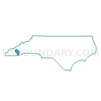
Outline

Summary
| Unique Area Identifier | 640531 |
| Name | Voting District HAMMNT |
| County | Jackson County |
| State | North Carolina |
| Area (square miles) | 66.50 |
| Land Area (square miles) | 64.22 |
| Water Area (square miles) | 2.28 |
| % of Land Area | 96.57 |
| % of Water Area | 3.43 |
| Latitude of the Internal Point | 35.18445050 |
| Longtitude of the Internal Point | -83.14684420 |
Maps


Graphs
Select a template below for downloading or customizing gragh for Voting District HAMMNT, Jackson County, North Carolina


Neighbors
Neighoring Voting District (by Name) Neighboring Voting District on the Map
- Voting District 06, Macon County, NC
- Voting District 07, Macon County, NC
- Voting District 08, Macon County, NC
- Voting District 09, Macon County, NC
- Voting District CAN, Jackson County, NC
- Voting District CAS, Jackson County, NC
- Voting District CUL, Jackson County, NC
- Voting District RIV, Jackson County, NC
Top 10 Neighboring County Subdivision (by Population) Neighboring County Subdivision on the Map
- Cullowhee township, Jackson County, NC (9,428)
- Millshoal township, Macon County, NC (2,802)
- Ellijay township, Macon County, NC (2,691)
- Highlands township, Macon County, NC (2,668)
- Cashiers township, Jackson County, NC (1,974)
- Hamburg township, Jackson County, NC (1,738)
- River township, Jackson County, NC (1,359)
- Canada township, Jackson County, NC (640)
- Sugarfork township, Macon County, NC (523)
- Mountain township, Jackson County, NC (492)
Top 10 Neighboring Place (by Population) Neighboring Place on the Map
Top 10 Neighboring Unified School District (by Population) Neighboring Unified School District on the Map
Top 10 Neighboring State Legislative District Lower Chamber (by Population) Neighboring State Legislative District Lower Chamber on the Map
Top 10 Neighboring State Legislative District Upper Chamber (by Population) Neighboring State Legislative District Upper Chamber on the Map
Top 10 Neighboring 111th Congressional District (by Population) Neighboring 111th Congressional District on the Map
Top 10 Neighboring Census Tract (by Population) Neighboring Census Tract on the Map
- Census Tract 9506, Jackson County, NC (10,568)
- Census Tract 9704, Macon County, NC (3,924)
- Census Tract 9507, Jackson County, NC (2,835)
- Census Tract 9509, Jackson County, NC (2,270)
- Census Tract 9508, Jackson County, NC (1,979)
- Census Tract 9705.01, Macon County, NC (1,435)
Top 10 Neighboring 5-Digit ZIP Code Tabulation Area (by Population) Neighboring 5-Digit ZIP Code Tabulation Area on the Map
- 28734, NC (27,040)
- 28723, NC (11,329)
- 28741, NC (3,197)
- 28717, NC (1,729)
- 28783, NC (1,593)
- 28774, NC (1,013)
- 28736, NC (787)